Forestry
Drone technology is now being used in multiple ways, including forest management. Learn about their purposes, background, benefits, limitations, and regulations.
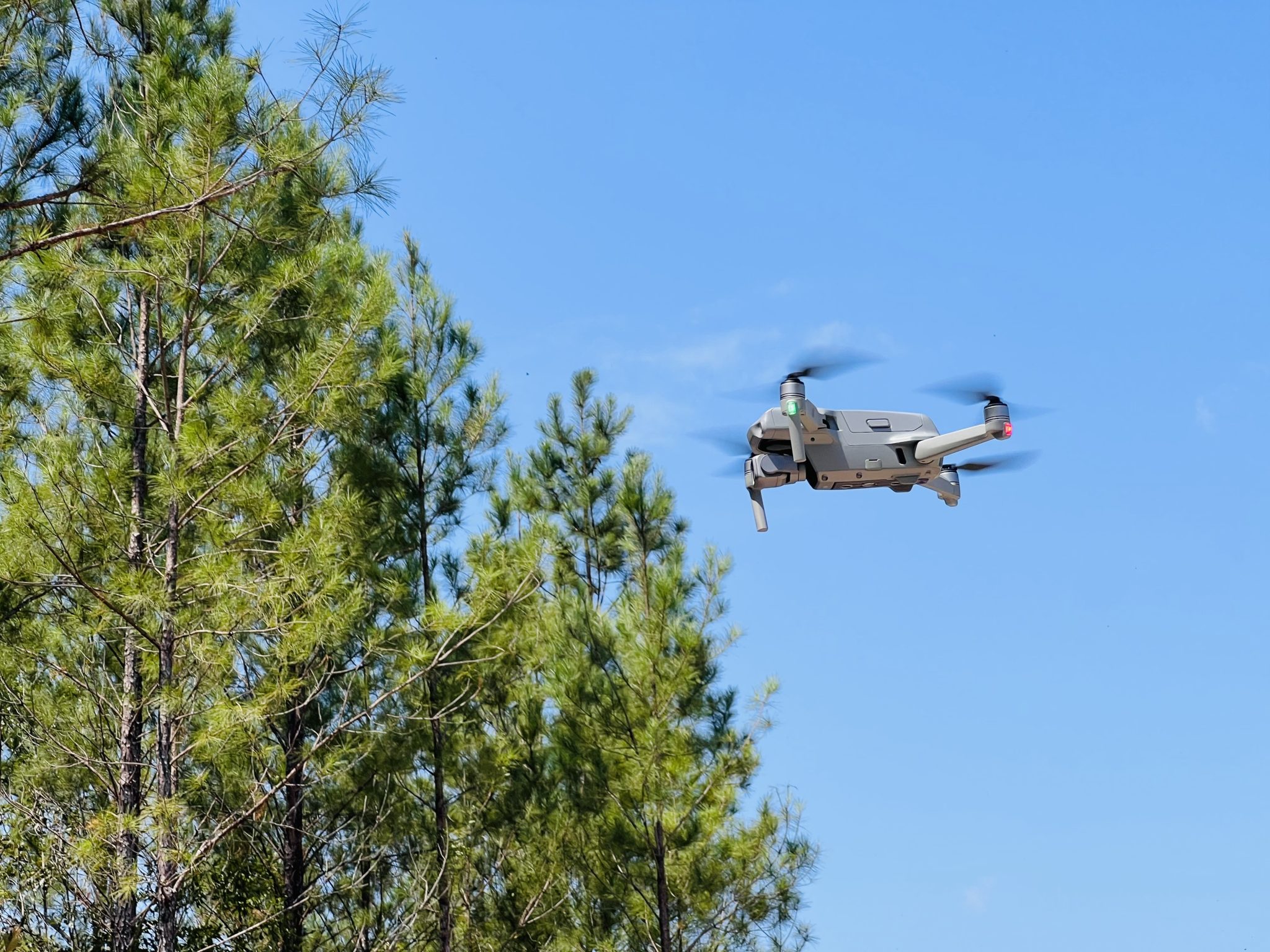
Unmanned aerial vehicles (UAVs), also called drones, were initially used for reconnaissance and surveillance in the armed forces. However, with the advancement of electronic technology, miniaturization, affordability, and efficiency of cameras and sensors as well as improved battery power, drones have become widely used in various industries. They are used for both recreational and commercial purposes. Drones have multiple applications, such as aerial photography, precision agriculture, disaster management, forest management, construction, mining, transport, telecommunications, and surveillance. This document will explore the use of drones in forestry and the importance of understanding their purpose, background information, benefits, and limitations.
Common Uses of Drones in Forestry
 Drones can serve as a valuable supplement to conventional data capture methods in the forest industry, providing a unique perspective and additional information that can enhance the quality of collected data. The use of drones can aid in the collection of various forms of data, including the following:
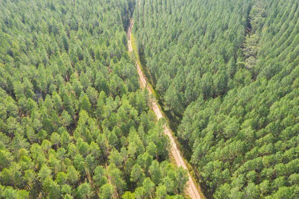
- Forest Management. Stand delineation/mapping, harvest planning, forest structure estimation and inventory, carbon inventory, damage assessments, forest disease/pest detection/mapping, forest fire detection/surveillance, and post-fire mapping.
- Landscape Management. Ecological mapping, park management, tourism, topographic modeling, soil
erosion mapping, and wildlife monitoring. - Monitoring Illegal Activities. Illegal logging, poaching, and encroachment.
Framework for Operating Drones in the United States
The Federal Aviation Administration (FAA) is responsible for overseeing and enforcing regulations related to civilian aviation safety, including the use of drones. Drones are governed by FAA regulations outlined in the 14 Code of Federal Regulations (CFR), Part 107, which includes guidelines for drone registration, flight altitude restrictions, prohibited areas for flyovers, and regulations for drone pilot behavior. The FAA also regulates airspace permitting and operations in appropriate areas; certain exceptions may apply depending on the type of drone operation. Recreational, commercial, and government drone pilots must follow specific requirements and steps (table 1).
What Kind of Drone Flyer Are You?
Table 1. Recreational, Commercial & Government Drone Pilots
| Recreational (Hobbyist) | Commercial | Public (Government) |
|---|---|---|
| Fly purely for fun or personal relaxation | Needed if done for business purposes such as marketing, inspections, journalism, filmmaking, etc. | Publicly funded law enforcement |
| Need to register drone at FAA DroneZone under the Exception for Recreational Flyers except for UAVs that weigh 0.55 pounds or less | Need to register drone at FAA DroneZone under part 107 | Fire departments and other government agencies |
| Recreational flyers registration: $5 per drone and valid for 3 years | Registration: $5 per drone and valid for 3 years | Can operate as a Public Aircraft Operation (PAO) with a Certificate of Authorization (COA) or operate under Part 107 rules |
| Do not require a remote pilot certificate | If the drone weighs 55 pounds or more, it must be registered using FAA’s paper-based registration process | |
| Requires remote pilot certificate under part 107–Unmanned Aircraft General-Small (UAG) aeronautical knowledge test | ||
| Must be at least 16 years old to get a remote pilot certificate |
Drone Rules & FAA Regulations
 Federal laws, guidelines, regulations, and policies related to drones can be found on the Federal Aviation Administration Policy Document Library website. In general terms, you should be aware of the following basic rules:
- Cannot exceed 400 feet above ground level (AGL) unless flown within a 400-foot radius of a structure and not exceeding 400 feet above that structure’s immediate uppermost limit.
- Do not exceed a ground speed of 100 miles per hour.
- Always yield the right-of-way to other manned aircraft.
- Do not fly in adverse weather conditions such as high winds or reduced visibility with a minimum visibility of at least three statute miles from the operator. If there are clouds, the drone must be at least 500 feet below the clouds and at least 2,000 feet horizontally from the clouds.
- Avoid flying while under the influence of alcohol or substances. The pilot’s blood alcohol level needs to be less than 0.04 percent.
- Do not interfere with an emergency response or law enforcement activities.
- Do not fly over people.
- Do not fly from a moving aircraft.
- Avoid operating the drone from a moving vehicle, except in instances where the area below is sparsely populated.
- Always check airspace maps before a flight. Applications like B4UFly, AirMap, etc., can be helpful in checking airspace. Obtaining FAA authorization through low-altitude authorization and notification capability (LAANC) and communicating with airport management and tower controllers is required when flying drones near airports.
- The FAA must be notified within ten calendar days when an operation results in severe injury or property damage of more than $500.
- The FAA requires that drone pilots maintain a visual line of sight (VLOS) with their drone at all times during a flight, and flying beyond line of sight (BLOS) is prohibited without a special waiver.
Selecting the Right Drone
When using drones for forestry purposes, it is essential to carefully consider your budget and specific use before making a purchase. All drones must have a remote ID by September 16, 2023, in compliance with an updated FAA ruling. Remote ID enables drones to transmit identification and location information to authorized entities. When purchasing your drone, ensure it is remote ID capable or upgradable. Drones can vary greatly in price depending on factors such as whether they are fixed-wing or rotary-wing as well as their intended level of use (consumer, professional, or enterprise). Fixed-wing drones are often used for large-scale mapping, meteorology, weather surveillance, and pipeline monitoring, while rotary-wing drones are commonly used for small-scale mapping, surveying, aerial cinematography, marketing, emergency response, and real estate. Although some fixed-wing drones can now take off and land vertically, in most cases, rotary-wing drones are more practical for forestry use as they can take off and land in confined areas. In contrast, fixed-wing drones typically require ample open space for takeoff and landing and can be more expensive. Consumer-grade drones typically fall in the price range of $300 to $2,100, while advanced-level systems (professional and enterprise) can range from $3,000 to $50,000 or more (table 2).
Table 2. Pros, Cons, Type & Cost Range of Rotary-Wing & Fixed-Wing Drones for Consumer, Professional & Enterprise Applications
| Airframe | Pros | Cons | Type | Average Cost Range |
|---|---|---|---|---|
| Rotary-Wing | Greater maneuverability | Shorter range | Consumer | $300–$2,100 |
| Ease of operation | Limited coverage area per battery | Professional | $3,000–$8,000 | |
| Higher payload capacity | Less stable in high winds | Enterprise | $3,800–$14,700 | |
| Hover ability | ||||
| High degree of stability | ||||
| Fixed-Wing | Significant range | Less compact | Professional, Enterprise | $8,000–$50,000 |
| Extended coverage area per battery | Less maneuverability | |||
| Linear flight advantage | No ability to hover in place | |||
| Challenging to fly | ||||
| Larger takeoff/ landing zone required |
The cost of a drone increases with the sophistication of its guidance system, control system, and the integration of additional sensor technologies. It is also worth noting that consumer-grade drones typically come equipped with a standard camera (red-green-blue or RGB). In contrast, professional and enterprise drones may not come with payloads (cameras and sensors) and will need to be purchased in addition to the drone. Consumer-grade drones can meet the need for mapping, harvest planning, general tree health assessments, and general site reconnaissance. An example of a professional or enterprise drone related to forestry would be using a thermal sensor for forest fire assessments, a lidar sensor for collecting more detailed forest inventory data, or a multispectral sensor for detailed vegetation health assessments (table 3).
Table 3. Types of Remote Sensors, Their Forestry Applications & Average Costs
| Type | Common Uses | Average Cost |
|---|---|---|
| RGB | Building 2D orthomosaic maps and 3D models, forest inventory, monitoring | Consumer—typically included Professional grade—$1,500 and up |
| Multispectral | To determine vegetation index/health and to understand soil condition | $8,000 |
| Hyperspectral | Tree species identification | $15,000 |
| Thermal | Locating and tracking wildlife, forest fires | $9,000 and up |
| LiDAR | Capturing forest structure, mapping individual trees, estimating biomass | $9,800 and up |
Checklist Before Going to Field
Site Assessment
Before embarking on a drone operation, it is essential to consider some vital logistical factors. One of the first things to check is whether FAA (i.e., near an airport/ airspace), organization/agency, military, etc. approval is required to fly. Also, verifying that you got permission from the landowner to operate on their property is essential. Airspace restrictions may be in place for specific locations with no-fly zones or flight restrictions. These can include military bases and airports, which are typically off-limits for drone usage. Additionally, municipal ordinances may restrict where drones can be flown, such as in parks or over specific public spaces.
These areas may require permits or approvals and a commercial license before operating a drone. To help determine if an area is within a restricted zone, the FAA suggests the B4UFLY app. This tool allows you to check for any potential airspace restrictions. If your intended area of operation falls within one, you must obtain authorization before flying. The FAA’s Low Altitude Authorization and Notification Capability (LAANC) system manages this authorization process.
Flight Planning
Check weather forecasts; it is essential to check the weather conditions and plan accordingly. Adverse weather, such as high winds, heavy rain or snow, and low visibility, can affect the safety and success of your flight. Setting up certain safety parameters before flying a drone is also essential. One key setting is the “return to home” function, which automatically returns the drone to its takeoff location if the battery runs low or the remote control signal is lost. Another important setting is the altitude limit, which ensures the drone does not fly too high and potentially violate airspace regulations or encounter obstacles. Setting up fail-safe operation settings is also recommended. This feature, which will help bring the drone back safely to the ground, will activate when the drone encounters a problem, such as a loss of GPS signal or a malfunction. To ensure a safe and successful flight, you must familiarize yourself with these settings and configure them correctly before operating your drone. Several applications are available to aid in creating autonomous flight plans for mapping purposes. These apps can help plan the flight path, altitude, and other essential parameters. Some apps are exclusively designed for iOS devices, while others can be used on iOS and Android devices. Some common applications are DroneDeploy, Dronelink, and Pix4Dcapture.
Update Drone & Controller
It is crucial to ensure that your drone and controller are fully updated (firmware) before heading out to the field. Even if updates were done in the days prior, it is still vital to double-check and ensure that everything is current, as the drone may not function correctly if there is a needed update. Additionally, cell service may be limited in some remote forest areas, so it is best to update everything before leaving for the site on the day of the flight.
What to Take With You (Figure 1)
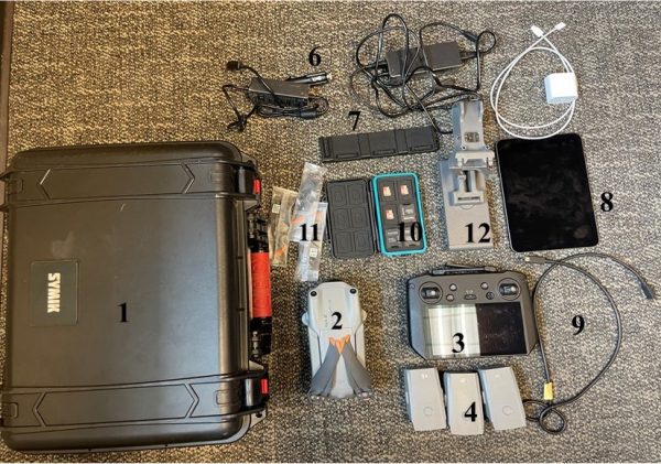
Figure 1. Essential equipment for drone applications in forestry.
1. Protective case (limits damage to the drone).
2. Drone.
3. Controller (may not have a screen built into the controller as pictured and will need an additional device such as the one mentioned in number 8).
4. Spare batteries. The number of batteries depends on the size of the forest area you will map, weather conditions, flight altitude, side lap, front lap, etc.
5. A landing mat (not in figure 1). Using a landing pad or mat when operating a drone is not always required, but it can protect the drone from debris and ground vegetation. A landing pad can also help signal other aircraft and people that drone operations are taking place, increasing awareness and promoting safety.
6. Charger cable. If you need to charge batteries in your vehicle.
7. Charging hub. Some drone manufacturers have charging hubs to charge batteries sequentially without swapping them.
8. iOS or Android device such as a phone or tablet.
9. Data Cable. To connect the drone to a device.
10. SD cards (stores drone images and data).
11. Extra set of propellers.
12. Tablet mount if not using a phone, as most controllers will only hold small devices.
 Arjun Rijal, Graduate Research Assistant; Richard Cristan, Extension Specialist, Assistant Professor; and Manisha Parajuli, Graduate Research Assistant, all in Forestry, Wildlife, and Natural Resources, Auburn University
New March 2023, Using Drones in Forestry, FOR-2137