Forestry
A management plan is a road map of the goals and objectives you have for your forested property. Planning starts with having an accurate property description and maps of your land.
A land management plan tells the story of your vision for your property. The best plan starts with a written property description along with property maps and aerial photos showing the current condition of your woodlot. This information will be needed as you and your forester or land manager outline the management activities needed to reach the desired outcomes.
Property Description
A written, detailed property description defines the area in which your forest is located, how many acres are owned, and locations of buildings, structures, or natural features found on your property.
The legal property description for your forested land can be found on your deed. It will include the state, county, township, range, and section. It may also include a portion of the section when applicable.
Township, range, and section are terms that identify the location of your property on a map. For example, township indicates the location of your land to the north or south of the map’s baseline, and range indicates the location east or west of the principal meridian.
Land surveys are sources of accurate property descriptions and property line designations. Property lines must be maintained with regular clearing, paint, and/or fencing. If you are unsure of your property lines, review your property description with your forester, surveyor, or other natural resources professional.
When writing your property description, be sure to include characteristics of your property:
- Legal description
- Total acreage
- Roads (dirt, gravel, or paved)
- Water features, such as creeks, ponds, or wetlands
- Buildings or structures, including rock walls, fencing, or old wells
Property Maps and Aerial Imagery
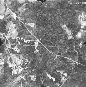
Figure 1. Aerial of Farmville, Lee County, Alabama 1958.
Gather any maps and images you have of your property. These may include topographic maps, aerial imagery, old photos of the site, or map printouts from internet sources. If you do not have any of these, work with land management professionals to locate appropriate resources. There are many sources of topographic maps and aerial imagery. The following are a few that are available to landowners:
- Alabama Air Photo Archive. This site provides historic aerial imagery for much of Alabama and can be downloaded free or for a minimal cost.
- Historic Aerials will provide past aerial photos of your land, if available, for a small fee (figure 1).
- Alabama GIS is a website that offers free aerial maps for almost every county in Alabama.
- USGS Geospatial Data Gateway is a library of free modern aerial imagery and geospatial data (figure 2).
- USGS Topographic Maps provides current and historic topographic maps of the United States. These maps can be downloaded for free, and paper copies can be ordered for a small fee.
Once you have a good written property description along with property maps and aerial imagery, you will be ready to sit down with your forester or other natural resources professional to begin developing the goals and objectives you have for your property. When the management plan is complete, make sure to review it each year to ensure that the goals you had at the time you wrote the plan have not changed.
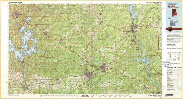
Figure 2. Map of Opelika, Alabama 1918.
 Lynn Dickinson, Regional Extension Agent, Forestry, Wildlife, and Natural Resources, Auburn University
New August 2021, Land Planning Essentials: Property Description & Maps, FOR-2104