Forestry
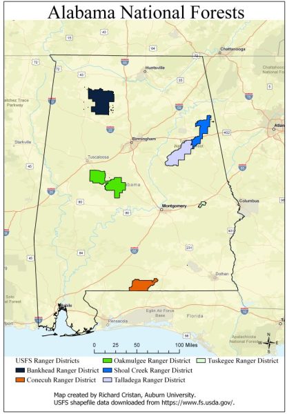
A map of Alabama’s national forests.
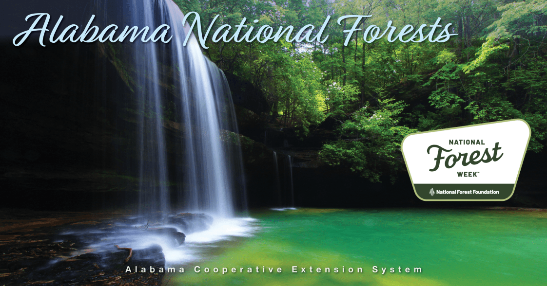
Did you know that Alabama has over 668,000 acres of national forests that are part of the United States Department of Agriculture Forest Service (USFS) National Forest System? In fact, there are four national forests in Alabama with six ranger districts. These forests include the Bankhead, Conecuh, Talladega (Oakmulgee, Shoal Creek, and Talladega districts), and Tuskegee. The national forests are located throughout the state and are in the Appalachian Mountains, Cumberland Plateau, Piedmont, and Coastal Plain regions.
Forest Characteristics
In 2022, the USFS conducted 128 controlled fires to promote healthy forests and wildlife habitat. These forests are home to over 850 terrestrial and aquatic species. Among these species are game animals–such as white-tailed deer, bobwhite quail, turkey, and waterfowl–and threatened and endangered species, such as the gopher tortoise and red-cockaded woodpecker. Timber is also harvested from these forests and is based on creating and managing healthy and sustainable forests.
There are three wilderness areas within the national forests in Alabama: Sipsey (approximately 25,000 acres in Bankhead), Cheaha (approximately 7,400 acres in Talladega), and Dugger Mountain (approximately 9,000 acres in Talladega). Wilderness areas are some of the most pristine lands in the US due to little influence from people.
Recreation
The national forest wilderness areas and other parts of these forests are open to recreation, but people must follow the seven leave-no-trace principles.
- Plan ahead and prepare
- Travel and camp on durable surfaces
- Dispose of waste properly
- Leave what you find
- Minimize campfire impacts
- Respect wildlife
- Be considerate of others.
National forests provide great opportunities for outdoor recreation such as hiking, biking, wildlife watching, hunting, fishing, boating, kayaking, canoeing, horseback riding, sightseeing, camping, and picnicking. There are over 368 miles of designated trails with the majority representing hiking trails (228.5 miles) followed by equestrian, off-road vehicles, and mountain bike trails. Some of the larger or more popular trails include the Pinhoti (Talladega), Conecuh, and Bartram (Tuskegee) trails. The USFS’s Know Before You Go website, www.fs.usda.gov/visit/know-before-you-go, provides up-to-date information on fees, site closures, road and trail closures/maintenance, prescribed burns, and wildfires that can help you plan a trip to any national forest.
More Information
More information can be found at the links below or by contacting Richard Cristan, an Alabama Extension specialist of forestry and wildlife sciences.
- US Forest Service: https://www.fs.usda.gov/alabama
- Maps (including free downloadable maps): https://www.fs.usda.gov/main/alabama/maps-pubs
- Know Before You Go (alerts): https://www.fs.usda.gov/detail/alabama/alerts-notices/?cid=stelprdb5212808
- National Forest Foundation: https://www.nationalforests.org/
- Wilderness Connect: https://wilderness.net/default.php