
Crop Production

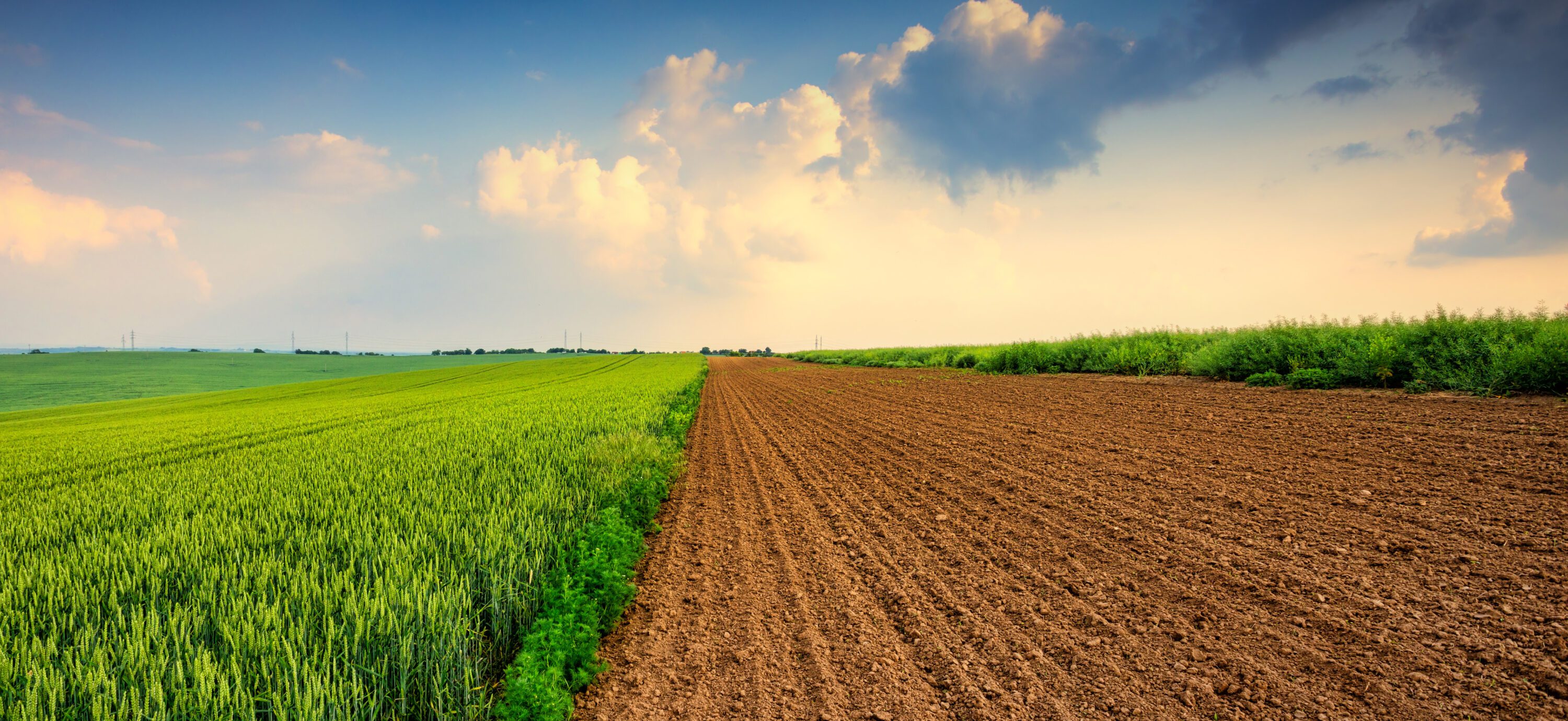
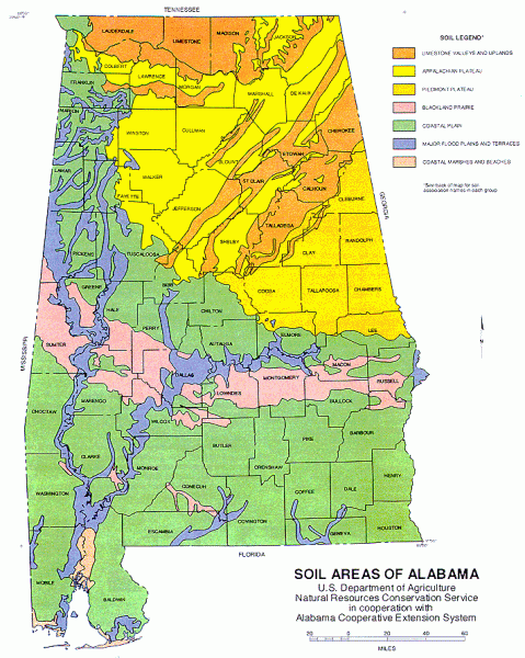
Figure 1. Geographic distribution of major soil areas in Alabama
Alabama features seven distinct soil regions, each with specific physical, chemical, and biological traits that affect the kinds of grains that can be successfully grown there. Understanding these regional variations is critical for producers to tailor management practices that maximize yield potential and long-term profitability.
Grain production varies significantly across Alabama based on the soil composition in seven distinct regions (figure 1). Key characteristics of each soil type and the variety of crops grown successfully in each of them are described in table 1.
To understand the real impact of these soil differences on grain production, it is helpful to look at recent harvest data. The USDA National Agricultural Statistics Service (NASS) groups Alabama’s agricultural production into specific districts that closely overlap with the state’s major soil regions. Table 2 shows the harvested area and grain yield for corn and soybeans across these agricultural districts from 2020 to 2023. These numbers show that average corn and soybean yields vary considerably across Alabama’s soil types. These variations can be explained by factors that affect the potentials and limitations of a soil type, as shown in table 3.
Table 1. Soil Characteristics and Main Crops Grown by Alabama’s Soil Types
| Soil type | Description | Crops |
|---|---|---|
| Limestone Valley and Uplands | Formed from limestone residuum and cherty limestone. Valleys are level to gently rolling (about 600 feet) and feature highly productive soils like the Decatur series. Uplands range from flat to steep (about 700 feet). | Cotton, corn, soybeans, wheat, and forages |
| Appalachian Plateau | Formed from sandstone and shale. Features broad, flat plateaus with loamy subsoils and slopes under 10% (about 1,300 feet) as well as steeper, rugged areas (300 to 700 feet) that are generally too steep for farming. | Corn, soybeans, hay, cotton, wheat, tobacco, fruits, and forages |
| Piedmont Plateau | Old, heavily weathered soils originating from granite, hornblende, and mica schist. Topography ranges from rolling to steep, with elevations typically 700 to 1,000 feet. | Corn, soybeans, wheat, cotton, pasture, forest, and fruits |
| Blackland Prairie | Unique region of alkaline soils (pH > 7.0) formed from Selma chalk and marine clays. Level to gently rolling terrain (about 200 feet) is characterized by vertisols, which require specialized management. | Soybeans, corn, cotton, wheat, and forages |
| Coastal Plain | Formed from marine and fluvial deposits. Soils typically have sandy topsoils and clayey subsoils (e.g., the well-drained Bama series). They are heavily weathered, acidic (pH < 6.0), and low in nutrients (0 to 500 feet). | Peanuts, corn, soybeans, cotton, wheat, and vegetables |
| Major Flood Plains and Terraces | Formed from alluvium deposited along streams and rivers. Features nearly level terraces suitable for cultivated crops and bottomland hardwood forests along stream floodplains. | Corn, soybeans, cotton, sorghum, and small grains |
| Coastal Marshes and Beaches | Deep, poorly drained soils occurring on nearly flat bottomlands, tidal flats, and beaches along the Mobile River, Mobile Bay, and the Gulf. Elevations range from sea level to just a few feet above. | Cotton, soybeans, corn, and peanuts |
Table 2. Corn and Soybean Average Yield (2020 to 2023) Across Soil Regions in Alabama
| Soil Type | Corn Area (acres) | Corn Participation % | Corn Average Yield (bu/ac) | Soybean Area (acres) | Soybean Participation % | Soybean Average Yield (bu/ac) |
|---|---|---|---|---|---|---|
| Black Belt | 17,160 | 6.45 | 124.6 | 19,140 | 7.01 | 41.0 |
| Wiregrass | 22,020 | 8.28 | 141.2 | 1,470 | 0.54 | 36.7 |
| Upper Plains and Piedmont | 11,293 | 4.25 | 147.1 | 9,003 | 3.30 | 46.8 |
| Mountains and Eastern Valley | 57,143 | 21.5 | 150.6 | 67,678 | 24.8 | 44.1 |
| Coastal Plains and Gulf Coast | 17,675 | 6.65 | 160.3 | 11,875 | 4.35 | 36.0 |
| Northern Valley | 140,603 | 52.9 | 160.6 | 163,913 | 60.0 | 43.7 |
| Total | 265,893 | 100 | N/A | 273,078 | 100 | N/A |
Table 3. Potentials and Limitations for Grain Production According to Soil Class
| Soil Type | Potentials | Limitations |
|---|---|---|
| Limestone Valleys and Uplands | Limestone Valleys: low acidity, fertile soils (high Ca and Mg), favorable topography, and highly mechanizable land Uplands: well-drained soils, excellent potential for pasture and forestry, with level areas suitable for row cropping | Limestone Valleys: limestone rock outcroppings in certain areas may interfere with agricultural machinery. Uplands: rolling to steep topography, shallow cherty/rocky soils, low natural fertility, and high erosion risk |
| Appalachian Plateau | Well-drained alluvial plains and valleys with fertile soils | Shallow rocky soils, rolling topography, and erosion |
| Piedmont Plateau | Well-drained and deep areas | Acidic, low-fertility soils, rolling topography, and erosion |
| Blackland Prairie | Fertile soils, favorable topography, and mechanizable soils | Vertisols, alkaline soils (pH > 7.0), severe erosion, low fertility from historical topsoil loss, and poor internal drainage |
| Coastal Plain | Good physical characteristics: well-drained soils, favorable topography, and deep soil | Highly weathered, nutrient-poor, acidic sandy soils with low water-holding capacity and high variability |
| Major Flood Plains and Terraces | Deep, fertile soils, favorable topography, and good water availability | Periodic flooding, poorly drained soils, high heterogeneity of soil types, limitations to mechanization, erosion, and sediment accumulation |
| Coastal Marshes and Beaches | Soils rich in organic matter and abundant water | Sandy, poorly drained soils affected by saline intrusion from seawater flooding, with difficulties for mechanization |
Strategies to Overcome Soil Limitations and Enhance Grain Production
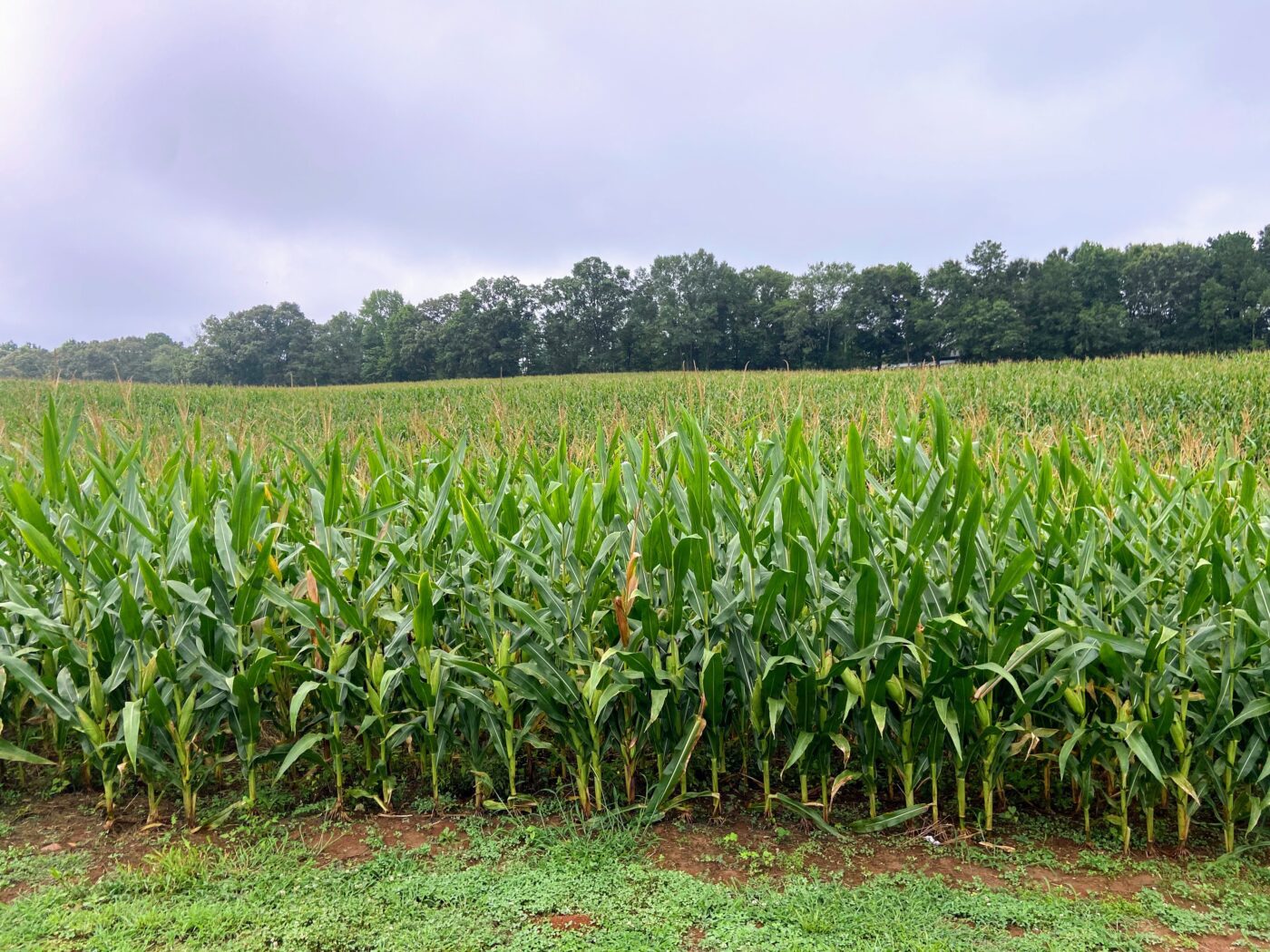 Proven soil management strategies exist for each Alabama region. By following these practices, farmers potentially can overcome the constraints of each soil type and fully realize the land’s yield potential.
Black Belt
One of the main challenges limiting corn and soybean production in this soil type is its high pH, which makes micronutrients (Fe, Mn, Zn, Cu) unavailable to plants, thus restricting growth and reducing yields. To address this issue, the soil can be acidified by adding acidic organic matter or using fertilizers such as sulfur, aluminum sulfate, and ammonium-based products. Over time, these inputs trigger chemical reactions in the soil that lower its pH to the ideal range of 5.5 to 6.5, making both macro- and micronutrients more readily available.
Coastal Plain
These soils are heavily weathered, leaving them nutrient-poor and resulting in very low soybean productivity. To address this issue, soil testing is necessary to determine the precise amount of nutrients required to maximize productivity. Building long-term fertility requires adopting no-till practices with the use of cover crops, which promote greater organic matter accumulation and enhance the soil’s natural fertility. No-till systems also improve water retention, an issue exacerbated by the sandy soils typical of these regions.
Limestone Valleys and Uplands
This region has good productivity for both soybeans and corn; however, certain factors still limit its potential, such as limestone outcrops and shallow soils. In these shallow soils, farmers are advised to select corn and soybean cultivars with shorter growing cycles. This is important because it reduces exposure to adverse weather and allows roots to absorb more nutrients from the upper soil layers. The selection of these cultivars can be made in partnership with seed companies or Extension specialists, which guide farmers on which varieties are better adapted to the region.
Appalachian Plateau
In this type of soil, corn and soybean productivity is high, like that in the Limestone Valleys and Uplands. However, these areas have rugged terrain, which makes mechanization difficult and increases susceptibility to erosion; therefore, adopting soil conservation strategies is essential to prevent these issues. These practices include using cover crops, such as oats, rye, clover, forage radish, and others, to keep the soil covered year-round. Another option is to adopt a no-till system to minimize soil disturbance and exposure. Planting along contour lines also helps to control surface water runoff. Combined, these strategies help reduce the effects of erosion.
Piedmont Plateau
This type of soil produces excellent soybean and corn yields. However, it has low natural fertility and is acidic, making it necessary to build long-term fertility through no-till practices and the addition of organic matter. No-till practices also help reduce erosion, which is common in these areas. In the short term, it is recommended that deficient nutrients be supplied directly to plants through localized fertilization, ensuring an immediate effect at planting.
Major Flood Plains, Terraces, and Coastal Marshes
These areas share significant challenges related to frequent flooding and poor natural drainage, which limit mechanization and lead to low productivity. Coastal areas also face the additional challenge of being extremely sandy and nutrient-poor. To address these issues, farmers should first conduct an economic feasibility study to determine whether surface or subsurface drainage is viable. If large-scale drainage is not cost-effective, the best approach is to plant waterlogging-tolerant or early-cycle cultivars to avoid crop failures during the wettest periods, or consider alternative crops better adapted to these wetland conditions.
Other General Strategies
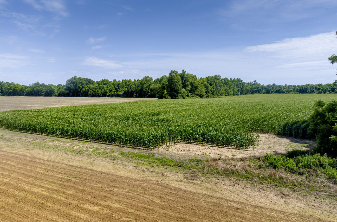 Several general strategies are available that address additional constraints present in soil types across Alabama.
Shallow and Stony Soils
Droughts are aggravated by shallower, stonier soils. One alternative to overcome this limitation is the use of short-cycle cultivars, which do not require deep roots and can be harvested before the dry season begins. Another alternative is erosion control, whether through use of no-till farming, cover crops, or integrated crop-livestock-forestry systems that reduce surface runoff, prevent soil loss, and help soil retain nutrients and conserve soil.
Undulating Topography
In areas of undulating topography, the risk of erosion is very high when the soil is exposed, and mechanization is also difficult. To reduce erosion risks, measures such as contour planting, terracing, and no-till farming can be adopted. It is crucial in these areas to avoid soil disturbance to prevent exposure. Where slopes are
not very steep, these lands also can be used for forage production.
Soils with High Limestone Content (Very Basic)
Soils with high limestone content are found in some areas of Alabama, which makes them very basic. This becomes a problem because elevated soil pH affects the availability of nutrients, such as phosphorus and certain micronutrients essential for plant development. To mitigate the effects of this alkalinity, fertilizers should be applied directly to the root zone of crops so that nutrients are not lost in the soil. For micronutrients, one strategy is foliar fertilization. In general, cultivation strategies in these areas include using cultivars more resistant to alkaline soils and practicing crop rotation.
Low Natural Soil Fertility
Low natural fertility of soils is a problem that affects several regions of Alabama, limiting grain production in the state. To address this issue in acidic soils, agricultural lime can be applied to raise and correct soil pH, alongside fertilization to supply deficient nutrients. These practices should be based on prior soil analysis. This ensures that only the necessary amount of fertilizers for the specific crop is added, enabling greater productivity at lower cost. Cover crops also can be cultivated to increase organic matter content, retain nutrients, and make them more available to plants. For more information on species selection and recommended management practices, refer to “Cover Crops for Alabama” (Extension publication ANR-2139) on the Alabama Extension website at aces.edu.
Vertisols
Predominantly found in the Blackland Prairie (Black Belt) region, vertisols are clay-rich soils with specific characteristics that can limit grain production. When very wet, they become highly compacted, and when very dry they shrink and form deep cracks. Both conditions limit mechanization. To address this problem, several practices can be adopted: increase organic matter content to improve soil aggregation and minimize fissures during the dry season; avoid excessive machine traffic during the rainy season to prevent compaction; and use adapted crops, which is also an excellent strategy for production in these areas. Drainage and irrigation can help prevent soils from becoming too wet or too dry, but an economic feasibility study is necessary to determine whether these higher-cost measures are truly viable.
Sandy Soils
In the southern region of Alabama, soils with high sand content are predominant. These sandy soils can pose major challenges for grain production if not well managed, since they have low moisture retention and high potential for nutrient leaching. Some crops are already adapted to sandier soils, but certain measures generally should be adopted for successful cultivation in the region. These measures include split applications of fertilizers (smaller, multiple doses throughout the crop cycle) to reduce leaching; irrigation when economically viable; use of cover crops to maintain soil moisture; and avoidance of unnecessary soil disturbance to prevent weakening of soil structure.
Poorly Drained Areas
In some regions of Alabama, poorly drained areas pose a major challenge for production because they favor diseases, reduce soil oxygen content, and limit mechanization. For these areas, cost feasibility must be analyzed. Practices to minimize the effects of poorly drained areas include subsoiling and surface drainage. Another important measure is detailed cultivation planning, aiming to plant at times when these areas are less subject to flooding. Finally, it is important to grow crops tolerant to waterlogged conditions so that they are less affected by the soil characteristics of these areas.
Conclusion
Adoption of these cultivation techniques, combined with the correct choice of cultivar and the appropriate planting season, can increase grain production throughout the state. The main limitations of agricultural production in Alabama present several viable alternatives for management; thus, producers are encouraged to consult their local county Extension office for specific, localized recommendations.
References
- Alabama Cooperative Extension System (ACES). 2018a. Major Soil Areas of Alabama.
- Alabama Cooperative Extension System (ACES). 2018b. Alabama Soils: Piedmont Plateau.
- Alabama Cooperative Extension System (ACES). 2018c. Alabama Soils: Blackland Prairie.
- Alabama Cooperative Extension System (ACES). 2018d. Alabama Soils: Coastal Plain.
- Alabama Cooperative Extension System (ACES). 2018e. Alabama Soils: Flood Plains, Terraces, and Coastal Marshes.
- Alabama Cooperative Extension System (ACES). 2018f. Understanding Soil pH.
- Gamble, A. 2023. Cover Crops for Alabama. Alabama Cooperative Extension System, ANR-2139.

Eros Francisco, Extension Grain Crops Agronomist, Assistant Professor, Crop, Soil, and Environmental Sciences, Auburn University, and Diego A. F. Freitas, Associate Professor, and Marcus V. Teixeira, GRA, both with Federal University of Vicosa
New July 2026, Grains to Grow in Alabama by Region, ANR-3266
For more information, contact your county Extension office. Visit aces.edu/directory.
Trade and brand names used in this publication are given for information purposes only. No guarantee, endorsement, or discrimination among comparable products is intended or implied by the Alabama Cooperative Extension System.