Forestry

Smart devices and unmanned aerial systems (UASs) are making geospatial technology more affordable, easy-to-use, and adoptable for a broader range of nontechnical users. SmartMap is an educational series providing hands-on training in the use of smart devices and UAS to collect, draw, and develop maps for improved forest management. Smart devices such as smartphones and tablets can support a variety of geospatial applications (apps) and GPS devices that integrate seamlessly to map, delineate, or identify management concerns both in the field and in the office. UAS offers natural resource managers the ability to collect real-time aerial imagery that integrates with smart device apps for up-to-date management. SmartMap offers the following educational programs:
SmartMap 1.0
SmartMap 1.0 introduces audiences to low-cost and easy-to-use geospatial mapping apps for smartphones and tablets. The class reviews the basics of geographic information systems (GIS), GPS and smartphone applications. It provides hands-on tutorials to give attendees experience using these technologies. This workshop also introduces audiences to UAS technology and its applications for video capture and forest mapping.
SmartMap 1.0 Learning Objectives
- Introduce audiences to GPS and GIS apps for iPhone and iPad
- Train audiences on using iPhone/iPad to collect GPS data in the field
- Train audiences to use the GIS KIT app to develop maps for natural resource management
- Demonstrate the capabilities of UAS for collecting real-time aerial imagery
- Demonstrate how to process and transfer UAS imagery and data to GIS apps
- Train attendees to share collected data with natural resource managers
Who Should Attend?
- Attendees with limited knowledge of GIS and UAS technology
- Forest landowners who want to improve mapping on their properties
- Wildlife enthusiasts interested in mapping their properties for improved recreation
- Recreational users who need to map forests for biking, hiking, or roads
SmartMap 2.0
SmartMap 2.0 uses a more advanced GIS application, ArcGIS Online, as the platform to train attendees in forest mapping. This course “unpacks” UAS technology and the applications and software needed to both scout and collect aerial imagery for map-making. While SmartMap 1.0 provides an introduction to UAV technology, this course provides a more in-depth review with hands-on training in the use of apps for planning and conducting UAS flights.
SmartMap 2.0 Learning Objectives
- Introduce audiences to ArcGIS online software
- Learn how to create maps with ArcGIS online
- Introduce audiences to low-cost UAS systems
- Review UAS sensors, including multi-spectral cameras
- Guide to planning and executing UAS flights using web-based applications
- Review UAS imagery applications and interpretation
- Exporting UAS imagery
Who Should Attend?
- Foresters & natural resource managers interested in adopting UAS and GIS in their businesses
- Landowners interested in more robust GIS software
- Real-estate professional interested in mapping and video capture
Upcoming Workshop Locations and Registration
There is a registration fee of $50 per individual, lunch included. Pre-registration is strongly encouraged, as registration is limited to 25 people per workshop. Programs with fewer than 10 individuals preregistered will be canceled.
Find a SmartMap workshop at a date and location near you here.
The fee is NON-REFUNDABLE. Requests to transfer your registration to another person must be made prior to the event by either e-mailing brodbam@auburn.edu or calling (251) 937-7176.
Available Continuing Education Credits
- Forester CFE
- Logger PLM
- Arborist CEU
- Engineering PDH
SmartMap Online
SmartMap Online is a virtual class that covers material from both the SmartMap 1.0 and 2.0 in-person workshops. The course is composed of short videos, including tutorials on using the various GIS and UAS applications. This program serves to both introduce and refresh audiences in using smart devices for GIS mapping and UAS aerial image capture and scouting. This program covers both the simpler GIS KIT application and the more complex and expensive ArcGIS Online software package.
SmartMap Online Learning Objectives
- Introduce audiences to GIS apps and GPS for smart devices
- Tutorials on using GIS Kit and ArcGIS Online for collecting data and building maps.
- Review the capabilities of UAS for collecting real-time aerial imagery
- Tutorials on using UAS web-based software for producing up-to-date aerial imagery.
Registration and Fees
- The online course is free to all registrants
- Those needing CEUs will be charged $10 at the conclusion of the course
- Approved CEUs include
- Alabama CFEs
- Alabama PLM
Enroll in the SmartMap Online Course
Questions?
Email your questions to Smartmap@auburn.edu.
Workshop Instructors

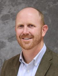
Beau Brodbeck
Alabama Cooperative Extension System
Beau Brodbeck is both an Extension Forestry Agent and an affiliate faculty in Auburn University’s School of Forestry and Wildlife Sciences. Beau holds a Ph.D. in forestry and is both an Alabama Registered Forester and ISA Certified Arborist. Over the past seventeen years, he has worked in various facets of forest and urban forest management. He began his career as a forestry consultant before joining Extension as an Urban Forest Specialist managing the Alabama hurricane recovery program. Over the past few years, Beau has developed a number of educational programs and publications to serve the forestry and urban forestry communities in Alabama.
 Christian Brodbeck
College of Engineering, Auburn University
Christian Brodbeck is a Research Engineer with Auburn University’s College of Engineering. He holds a B.S. degree in Biosystems Engineering and a M.S. degree in Civil Engineering. A registered Professional Engineer, Christian has worked for Auburn University for 12 years focusing his first four years of research on Precision Agriculture. Christian spent the next six years working in the area of bioenergy, in particular conversion technologies of woody biomass and harvesting logistics. In recent years Christian developed an Unmanned Aircraft Systems (UAS) program for the College of Agriculture and is a Part 107 licensed remote pilot with over 400 recorded flights.
The SmartMap programs are funded in part by the Bradley Murphy Trust. Learn more about the Trust and its goals of improving the management of private forests by encouraging productive business relationships between forest landowners and consulting foresters and by improving the quality of private services available to forest landowners.

