Fish & Water
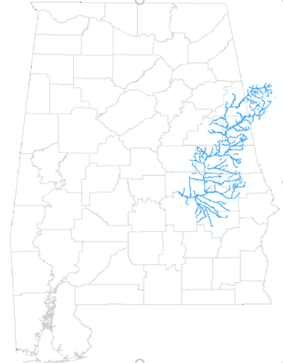
Map featuring Tallapoosa River Basin streams.
Image from Sydney Zinner
With 132,000 miles of streams and rivers, Alabama has been called “the River State.” The Tallapoosa River is one of Alabama’s major waterways. It begins in the Piedmont of northwest Georgia and flows southwest through four Georgia counties and 12 Alabama counties until it meets the Coosa River just north of Montgomery to form the Alabama River. That Alabama, Coosa, and Tallapoosa Rivers form what is collectively known as the ACT River Basin.
The mainstem of the Tallapoosa is nearly 260 miles long and the majority (85%) of the river is in Alabama. The Tallapoosa Basin encompasses 4,675 square miles and is largely underlain by granite bedrock. Granite is a crystalline rock that is resistant to erosion. Due to this, the Tallapoosa River and its tributaries are softer (contain less mineral content), clearer, and less biologically-productive than neighboring river basins.
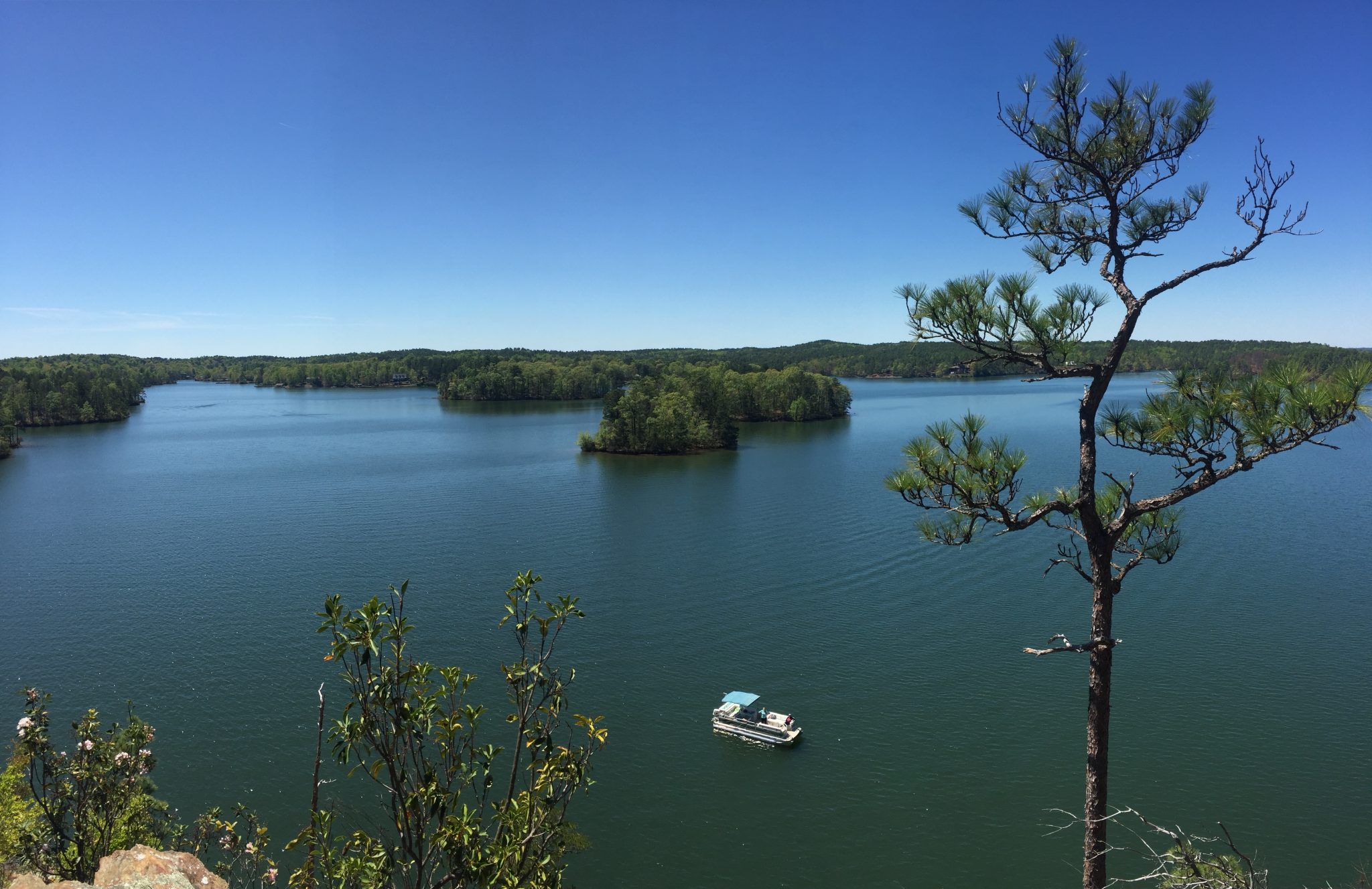
Alabama Power Company operates all the major hydroelectric dams on the Tallapoosa River including the dams that form several popular reservoirs. In 1926, Martin Dam was built and created Lake Martin, which was the world’s largest reservoir at the time of its creation. The Lake is over 150 deep at Martin Dam and is the largest reservoir in Alabama in terms of volume of water. It counts for 31% of the water storage volume for the entire Alabama-Coosa-Tallapoosa Basin. Yates Lake, created in 1930, covers 1,980 acres. R. L. Harris Lake, also known as Lake Wedowee, was created in 1962 and covers 10,661 acres.
The Tallapoosa Basin is full of aquatic life including a suite of freshwater mussels many of which are rare, and even federally threatened or endangered. The Ovate clubshell, Southern clubshell, and finelined pocketbook are all examples. Explore more about Alabama’s mussels on the ADCNR Mussel StoryMap.
-

- Horseshe Bend Kayak Syd and Fam
-

- Chimney Rock at Lake Martin.
-
-
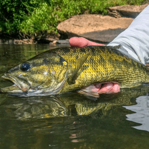
Tallapoosa Bass
Image by Drew Morgan
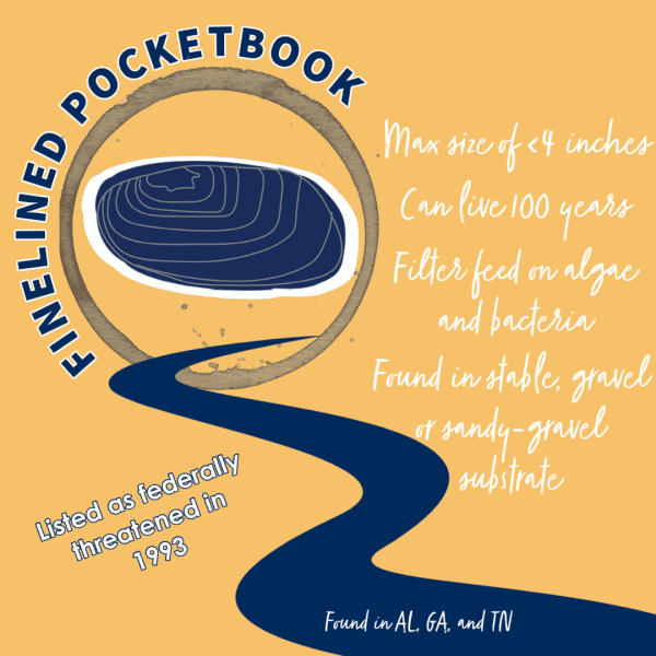
The finelined pocketbook is a medium-sized freshwater mussel that rarely exceeds 4 inches. Individuals can live for up to 100 years. Pocketbooks, like other freshwater mussels, are filter feeders of algae and bacteria that are typically found in habitats with stable gravel or sandy-gravel substrate.
Fish species found in the Tallapoosa Basin include the lipstick darter, speckled darter, Tallapoosa darter, stippled studfish, Tallapoosa shiner, largemouth bass, redeye bass, Alabama spotted bass, etc. The beautiful Tallapoosa bass is an Alabama endemic species that prefers rocky habitat with flowing water. They are typically between 5 and 16 inches long, slender, and known by anglers to be an especially hard-fighting fish.
In addition to boasting the only “Alabama Treasured Lake,” Lake Martin, the Tallapoosa River Basin is also home to one “Outstanding Alabama Water,” Cane Creek near the Alabama-Georgia border. Unfortunately, there are 37 waterbodies in the Tallapoosa Basin that are listed as impaired waters (not meeting water quality standards) on the Alabama Department of Environmental Management (ADEM) 303(d) List of Impaired Waters. Tallapoosa waterbody impairments include mercury due to atmospheric deposition, organic enrichment, siltation, and pathogen pollution due to fecal contamination.
Read more about the Tallapoosa River Basin and other rivers in the Alabama Water Watch Blog Series about Alabama River Basins.